This is now a read-only archive, and will likely be pulled down in a year or so.
For the MF3D comment site, please visit https://folio.solidsight.net/
This is now a read-only archive, and will likely be pulled down in a year or so.
For the MF3D comment site, please visit https://folio.solidsight.net/
I have chosen a selection of views that are already prepared, since I was suddenly invited to join the folio, accepted, and then was handed the folio. This took less than 2 days. Then Ian gave me a week to send it back to him,… the next name on the list.
Anyhow, I am happy to be welcomed into this folio.
A couple of these views may be remembered if you have spent a few years in Folio A.

Charles Bridge, Prague
This image was taken with twin Lubitel cameras with the two hand cable release method. It is a mild hyper image, as are all my twin Lubitel images.
I set this up on the west bank of the Vltava River on the south side of Charles Bridge (Karluv Most).

Cherubs in the Lillies
This shot was taken in my yard, almost certainly taken with Provia 100f film, on my TL120, before it started to give me trouble. This is always a tempting subject, once a year.
The following two images were taken at the Milton Steam fair, just a little west of Toronto, which is held every labour day. I like this fair since it provides so many opportunities for making stereo images, and I like steam engines, and steamed corn.

John Deere Heaven
This image was taken at the John Deere area of the fair. You can see that the fair takes place at a pioneer village, where there are plenty of historical buildings to stage these stunning tractors.
 Two Veterans
This collector brings his steam tractor to this event every year. He kindly consented to have his picture made.
This is one of may favourite portraits. I love this guy,…you know… in a photography sort of way.
I belong to a number of Photo Walk groups here in Toronto. Participating in a Photo Walk is a great way to get one’s steps in, socialize with like-minded folk, and maybe use a camera that hasn’t been taken out in a while. If one is not driving, one can join one’s aforementioned like-minded friends in quaffing great flagons of beer after the walk, get sotted and beligerent, tip over tavern tables in anger, and tell everyone in the room what one REALLY thinks of them and their pretentious little point ‘n’ shoots.
“BETWEEN A ROCK AND A HARD…….ROCK”.
Captured during an excursion with the (Toronto) ANALOG FRIENDS photo walk group. TL-120-1, Kodak E100SW

“A STREETCAR NAMED RETIRED”.
Made on a solo photography jaunt. Sometimes you don’t want to be with others and their YouTube Influencer cameras. TL-120-1, Kodak Lumiere LPP
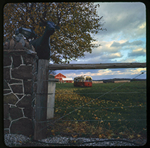
“CURB APPEAL”.
Snapped during a pleasant meandering with the TORONTO FILM SHOOTERS photo walk group. Sputnik, very expired and damaged AGFA APX 100 (Foma-R reversal kit)

“DOWN BY THE BAY”.
Photographed during a chilly Fall cattle drive with the TORONTO PHOTO WALKS (TOPW) photo walk group. There was an actual theme set for this photo walk, which was “Towers and Reflections”. Stereo Samulette, Kodak E100S

I tried to provide a variety of subjects in this submission. All are taken with a Mercury Stereo 12, with a variety of lenses. And perhaps most interestingly, none of these are shot on contemporary slide films. Three of the four are shot on negatives and printed to slides using M-Alchemy‘s new M-Chrome process, while one is shot on 40-year old Ektachrome 64!

Part of a “cinematic” series I shot in 2023, this image was taken in an impossibly tight space with the 47mm Super Angulon lens, one of my absolute favorites. This is Kodak 250D cinema film pushed to 1600 ISO, printed by M-Alchemy into slide form. This is an example of a shot that wouldn’t be feasible with slide film; the color would be far off, detail would be gone, and the exposure would be far too long for human subjects. A lot of dramatic license is taken in this narrative image; I hope you find it interesting!
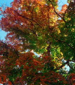
Here I tried to capture different colors at different heights of this tree. While this would have worked just fine with slide film, I wanted to test the M-Chrome process (negative to slide printing) for color saturation, and was quite pleased with the result. 80mm lenses.

If M.C. Escher was an urban designer? This was a real infrastructure project in my neighborhood that I stumbled across one day. I thought such a bizarre subject deserved some retro film, and shot it on 70mm Ektrachrome 64 that expired in the 1980s. 55mm lenses.
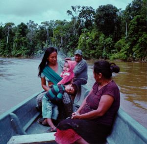
I shot this deep in the Amazon jungle, about 8 hours (by car and canoe) from the nearest modern infrastructure or town. The Wairani people have very little contact with “modern” communities, and retain many of their traditional ways. Here a family was kind enough to take me on a canoe ride to their home. This negative went through hell, but I still thought it would be interesting to make an M-Chrome of it. 65mm lenses, ISO 400-800 (I can’t remember exactly).
“Maine White Birch” was taken in my brother’s trailer park several years ago, but the 20 plus birches there have mostly been scoured out by the new park owners. However, the park’s wild turkeys are back and I shot three of them in August, though with a W3 since carrying the Sputnik and Rolleidoscop around is a pain.
-Jim Roy
Sinks of Gandy, Randolph County, W.Va.
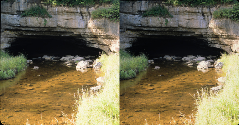
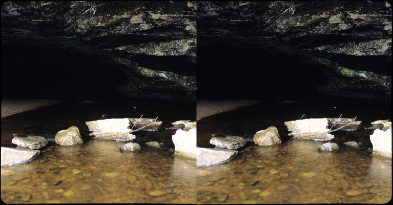
Upstream Entrance of the Sinks of Gandy (wide view & closeup). Gandy Creek flows right under a ridge extending out from Yokum Knob, emerging back into daylight about half a mile to the east. The cave has been well-known & heavily visited since at least the 1830’s, although it was never operated as a tourist attraction. (You can read about it in Wikipedia.) It’s one of my favorite places, although I slipped on the wet rocks & hurt myself rather badly while wading around to take these photos. At least my camera survived!
TL-120, Provia 100F. 55mm lenses would have been great for this.
Mouth of Thorny Creek
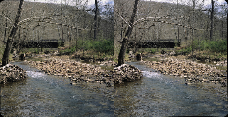
Thorny Creek emptying into the Greenbrier River, Pocahontas Co., W.Va. The old railroad bridge in the background carries the Greenbrier River Trail, popular for hiking & cycling. This is about 4 miles upstream from Marlinton.
TL-120, Provia 100F.
Fallen Tree on the Bank of the Greenbrier River near Thorny Creek
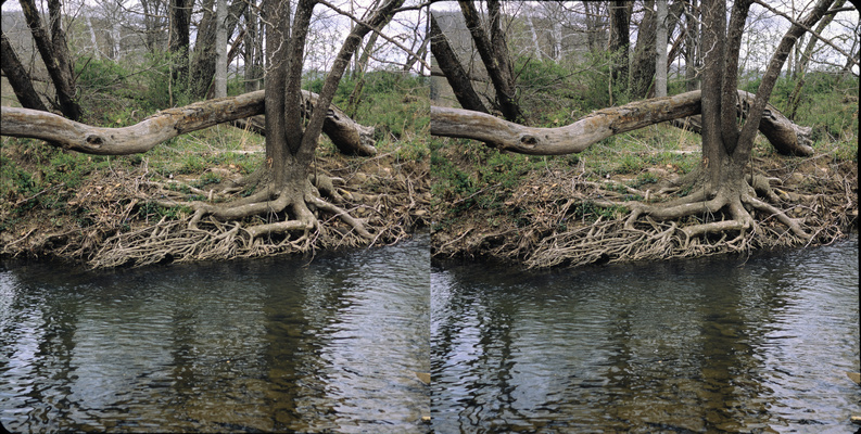
I think I was on an exposed gravel shoal for this one, not actually wading. Those rocks sure get slippery!
TL-120, Provia 100F. Probably f/16.
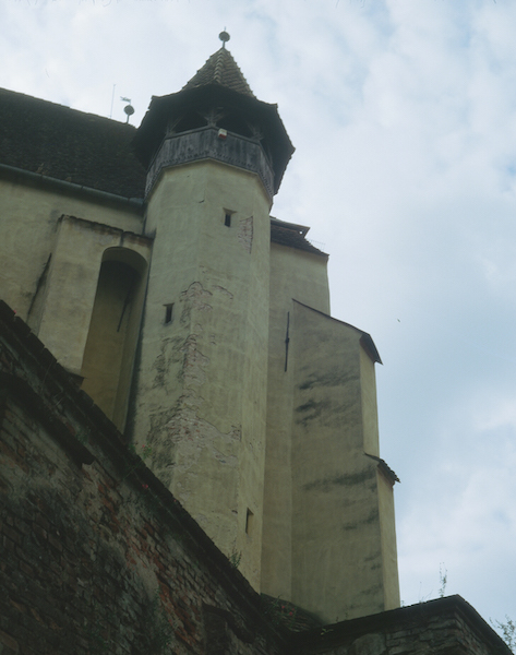
Last year Liz and I decided to take part in Chris Marquardt’s Eastern Europe Electric Photo Road Trip. This was a combined guided tour, and photo workshop. We went from Transylvania, to Budapest, Vienna, Prague, Dresden and ended up in Berlin.
This is a view from outside the defensive walls of the Biertan Fortified church in Transylvania, Romania. These churches were fortified in response to the Ottoman army in the area at the time.
This was taken with a handheld (string monopod) Sputnik on Kodak E-100.
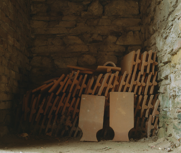
These tiles were stored in an alcove off the pathway inside the outer wall of the fortified church.
It was a bit tricky to mount this pair. I could probably have done with a 4.5×4.5 mount if they existed.
This was taken with a Sputnik resting on a bean bag on Kodak E-100.

After the photo trip was done Liz and I stayed on in Berlin so we could visit where her mother grew up.
This is Kaiser Wilhelm Memorial Church. The building in the cneter was built by Kaiser Wilhelm II in the late 19th century, and named in honor of his grandfather Kaiser Wilhelm I. This church was heavily damaged during an Allied bombing raid in WWII. Today it is a memorial hall, and contains a Cross of Nails made from the roof timber nails of Conventry Cathedral in the UK . The building on the left is the new church built after the war.
This was taken with a handheld (string monopod) Sputnik on Kodak E-100.

This is a closer view of the original portion of Kaiser Wilhelm Memorial Chuch. Here you can see where the rose windows were blown out, and the shrapnel damage on the outer walls.
This was taken with a handheld (string monopod) Sputnik on Kodak E-100.
Please leave your comments for Bert McIlwain’s D25 submission below this post.
-Ian Andvaag
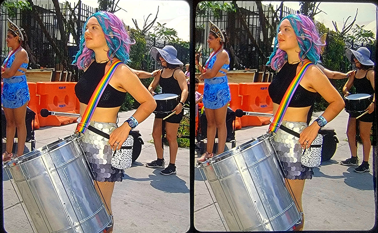
Jim Harp “Surdo Player”
Photographed at the 2023 Coney Island Mermaid Parade. TL-120 with Vivitar 285H fill flash, Provia 100F pushed one stop. The biggest challenge at the Mermaid Parade is getting a shot that doesn’t have another photographer cutting in front of you!

Jim Harp – Double Trouble
Photographed at the Air Power museum in Farmingdale NY, October 2019. TL120 with Vivitar 285H fill flash. Ilford Pan-f, DR-5 processing. DR5 suggests rating Ilford Pan F at ISO 20 so this was probably a half second exposure.

Jim Harp – Tibetan Buddhist Temple, Mussorie India
There is a thriving Tibetan community in Mussorie India. This was photographed in 2012 with a TL-120 with a Vivitar 285H fill flash. Provia 100F pushed one stop.

Jim Harp – Hailey and the Excalibur
Photographed at a “Tilted Kilt” car show in Bolingbrook Illinois, August 2023. TL-120 with Vivitar 285H fill-flash. Provia 100F pushed one stop.