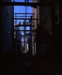
 Taken with the TL 120 using Velvia 50. As I finished a guy ran out of the alley yelling at me a s I sped away! I guess he’s not a fan of 3D!
Category Archives: a29
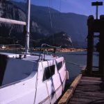
Sailboat, pier, logs, Squamish, BC
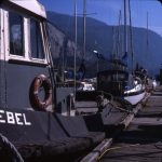
Ebel, Squamish, BC
Red Rock Canyon – Waterton Lakes
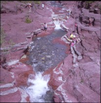 The red rocks provide an unusual background to this otherwise typical scene of people relaxing while enjoying an idyllic scene. The alluvial rocks in the stream bed are not red like the canyon, and have been carried down to the canyon from up the mountain. We fell in love with Waterton Lakes National Park in south-western Alberta during this our first visit. Original slide taken June 7, 2015 with a tripod-mounted Heidoscop using Provia 400X exposed at 1/160 at f16. This was my last roll of Provia 400X; it is sorely missed.
Ghost Trees, Upper Geyser Basin – Yellowstone
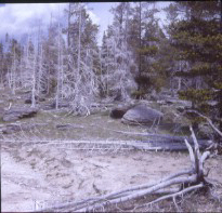 These white dead trees create an otherworldly scene around many of the geysers at Yellowstone. I am not sure why living trees are growing amongst them: are the dead trees silicified and preserved, to be joined by the living trees when they succumb to the harsh environment; or perhaps the conditions have changed allowing a new generation of trees to survive; or perhaps the dead trees were burned in one of the many forest fires that occurred at Yellowstone before being covered in the minerals expelled by the geysers. Original slide taken June 1, 2015 with a tripod-mounted Heidoscop using Provia 400X exposed at an estimated 1/250 at f25.
Belgian Pool – Yellowstone
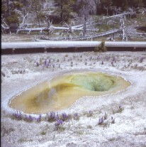 The Belgian Pool was named for a tourist from Belgium who was killed in 1929 after falling into the pool. Enthralled by an eruption of Grand Geyser, the unfortunate man apparently wasn’t watching where he was stepping. The range of colors is caused by the variation in the composition of the microbial mats caused by the change in temperature at different parts of the pool. (The colors would have been more intense with polarizing filters but I don’t have two polarizing filters. This more intimate scene is more effective with the regular lense separation of the Heidoscop than the shots I did of Old Faithful and other majestic scenes in Yellowstone and the Grant Tetons, most of which would have benefited from hyper stereo.) Original slide taken June 1, 2015 wit ha tripod-mounted Heidoscop using Provia 400X exposed at 1/200 at f22.
Three Lonely Crosses
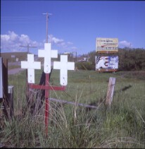 Do these three crosses stand in memory of three people that lost their lives at this lonely crossroads? If yes, what complex lives are reduced to these simple white crosses? What happened? This shot was taken at intersection of US 287 and MT 200, north of Wolf Creek, Montana. The crosses are not present in Google streetview from June 2009. Original slide shot June 6, 2015 with a tripod-mounted Heidoscop using Provia 400X exposed at 1/160 at f25. (I was going to call the image “God Bless Ame”, after the billboard, but changed my mind as I felt it was going to change my intent.)
Flowers on Stone
Juneau is a gold mining town. 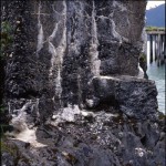 Every where you turn, you find remnants of the placer and hard-rock mining. South of Juneau, a pier stand abandoned in the water. Its pilings are bleached and trees grow from its surface. On the shore stand the pillars which supported the rail-line out to the pier.
When it was a working facility, the ships from Seattle would dock here in Dupont to offload their cargo of dynamite. It would be trundled down the rail-line to an elevated warehouse along the shore. From there, smaller loads would be transported by boat to the mines in Treadwell, Douglas, and Juneau.
Excepting the iron bits, the pier, dock, and warehouse were built from local materials. This image may be better named, Flowers From Stone, as the concrete is covered with the efflorescence from the beach sand and gravel.
I tried to set the focus and aperture to let the distant pier fall out of focus. I think I could have opened the aperture a bit more.
Lunch on Ice
Once again, I’m chasing the retreating ice.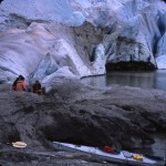 More often than not, there is now a kayak pulled up on the rocks after I’ve walked all the way out. It would be a lot quicker way to arrive than on foot!
In this case, this group arrived in a pair of kayaks and settled in for lunch before doing their exploring. The “rock” they are on is actually a gravel-covered block of ice. The ice will melt over the next couple of months, leaving only a pile of sand and gravel. The fall rains and winter snow will probably wash the remaining sand down into the lake by spring.
The area of darkened ice on the face of the glacier is an area where the under-ice river flows out into the lake. The in-rushing water is leaving ripples in the otherwise still lake.
Home of the Nymph
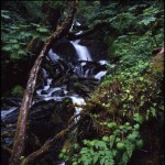 You might be tempted to misidentify this as your basic, Southeast Alaska, rainforest stream. There are so many of them, it’s hard to get anywhere without having to find your way across a couple dozen of them. But this, I’m sure, is the home of an elusive Water Nymph. I’ve tried numerous times to catch a glimpse, but I’m always disappointed. I probably make so much noise getting through the undergrowth, that she’s able to make herself scarce before I arrive.
Where the Rain Fell
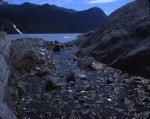 In the summer of 2015, I did another long walk looking for tripod holes. I load my pack with a TL120, a digital SLR, maybe a W1, a box of slides, and a STL viewer. The task is to find the locations, and recreate the view. The challenge is to make an engaging image in a location which probably no longer has the jaw dropping magnificence of its youth.
It is hard to suppress the cringing and pain I feel as I search for tripod holes. I have a visual memory. My trek across the barren rock is a long slow playback of previous excursions, narrated by my little voice, “I remember when . . .”, “We forded the stream up there . . . “, “This used to be . . .”.
This location happens to be where 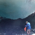 I made some of my favorite images. I know one made it into the folio. Others, including Raining Tunnel, made their way into a slide display at the NSA convention in Colorado. The camera location recorded in this thumbnail (from 2010) is just about where the cliff wall exits the right side of the stereo view. In this case, I was unable to create any meaningful image by putting my tripod back into those holes. I chose, instead, to move my camera to the vantage point from which I had made the 2010 self-image.
In 2010, the water ran into a ice tunnel of uncertainty and opportunity. I knew it fell into the lake somewhere, but how far would I venture into that tunnel to find and capture images. In 2015, it is a spread of certainty. The fireweed and willow have taken root, the stream runs in the open, and a Southeast rain forest will soon own this location.
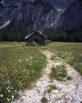
Alpine Barn, Dolomites, Italy
Dolomite Mountains
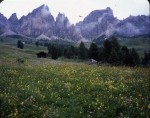 Location Alta Via Trail, 3 hrs N Venice
Technical Fuji GA645w (cha-cha no slide bar ), Fuji Provia F100
Comments In July of 2014 my wife and I trail ran and trekked the
Dolomites in the Italian Alps. There is a lot to see here: the classic
Dolomite peak craggy rock formations, the wild flowers that slowed down
just enough for me to take this stereo pair cha-cha, maybe not the
moving clouds in the bg.
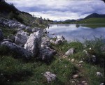
Lagazuoi Sauna, Dolomites, Italy
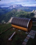 Location Alta Via Trail, 3 hrs N Venice
Technical Fuji GA645w (cha-cha no slide bar ), Fuji Provia F100
Comments In July of 2014 my wife and I trail ran and trekked the
Dolomites in the Italian Alps. This view is the famous sauna at the
Lagazuoi refugio that awaits you after a long trek to get there.
